Old House Fair
Old House Fair Celebrates 20 Years in South Park
South Park’s Annual Old House Fair, the community’s historic home tour and exhibition, returns on Saturday, May 19, from 10 a.m. to 4 p.m., starting at The Rose Wine Bar, located at 2219 30th Street.
Produced by the South Park Business Group, the Old House Fair brings together vintage home specialists, historic preservation enthusiasts, home owners, history lovers and community members in celebration of the neighborhood’s unique charm and character.
Marking the fair’s 20th anniversary, six South Park properties will be featured, along with new activities, including a series of free 30-minute talks led by vintage home preservation and restoration specialists. One of the highlights of the fair will be the newly designated historic district, running from A to Elm Streets and 28th to 31st Streets.
Also new for 2018 is an architect-led bike tour of historic and modern homes built by notable architects, departing at 11 a.m. and 2 p.m. The Rose Wine Bar is the new starting point for the event where the ticket booth, trolley starting point, and exhibitor displays and talks will be held.
“We hope the additions to our program will give attendees a newfound appreciation for our historic community,” said Jean Rivaldi, president of the South Park Business Group. “The bonus is that proceeds from the event go back to the South Park Business Group to help fund projects like neighborhood beautification, clean-ups and public art.”
Each home tour ticket includes docent-led education and history, trolley access, and a special 20th anniversary program guide featuring South Park’s history and photos of homes on tour from the past two decades. “Deluxe” ticketholders will receive a complimentary mimosa, commemorative tote bag and bike tour ticket.
Home tour tickets are $30, Deluxe tickets are $50 and bike tour tickets are $5. Online sales begin on April 1. Tickets can also be purchased at the event. For more information or to purchase tickets, visit www.oldhousefairsd.com.
__________________
SPAWAR Receives Secretary of the Navy
Award for 3-D Ship Scanning Technology
By Dawn Stankus | Space and Naval Warfare Systems Command
Virtual reality (VR) surrounds the lives of civilians and military members serving the Department of the Navy
every day. Whether a person goes to the movie theater, sporting event, theme park or plays video games in the comfort of their home, VR becomes something tangible and real in their lives. Now, the intricacies of VR and virtual environments (VE) are becoming a part of training, shipboard modernization, equipment installations and operational environments facing warfighters today.
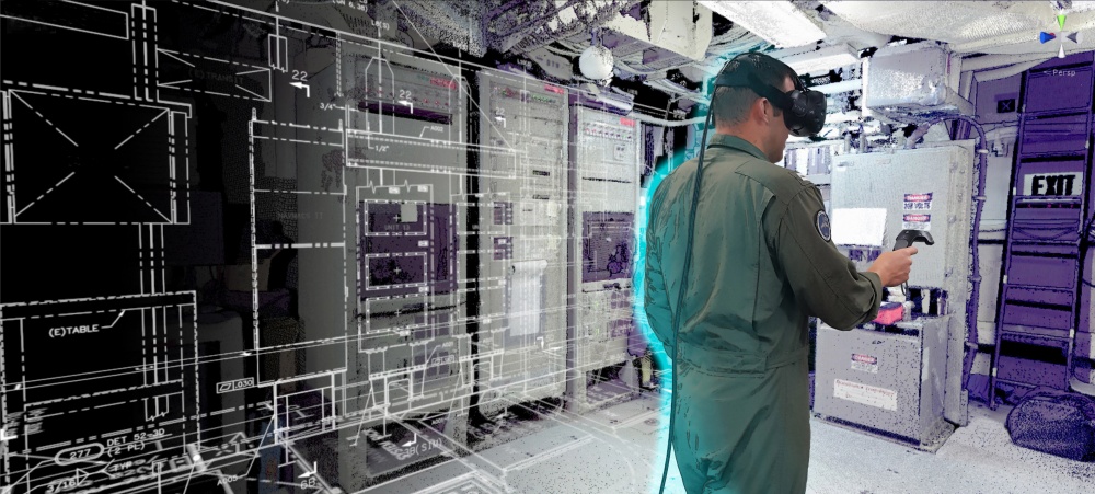
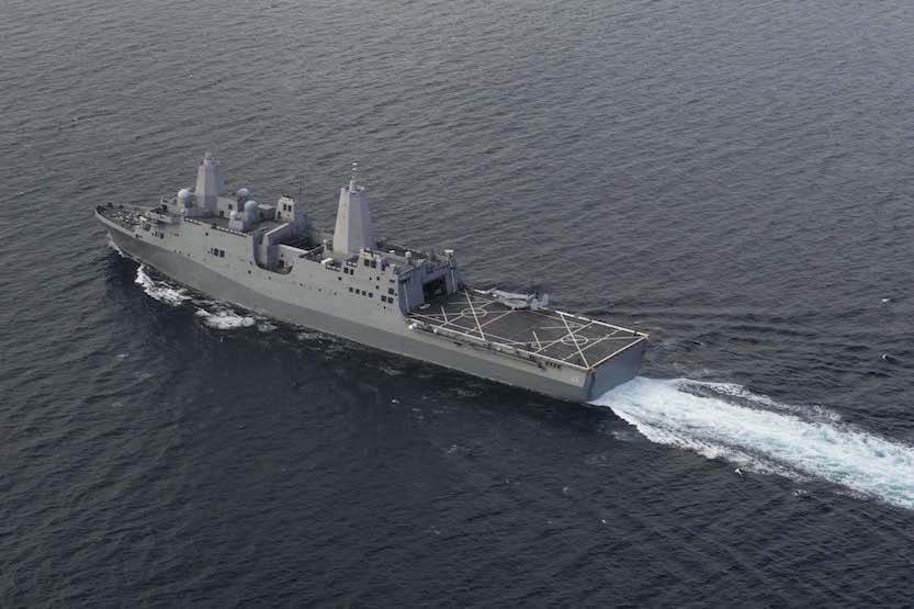
Last year, the San Diego-based Space and Naval Warfare Systems Command (SPAWAR) formed the three-dimensional (3-D) Ship Scanning Team to attack shipboard configuration management and to find new innovative techniques to further the SPAWAR mission of accelerating and streamlining delivery and installation of assets to the fleet and to reduce the cost of normal operations. Utilizing commercial off-the-shelf (COTS) technology, the team took accurate 3-D representations of three operational ships scheduled for upcoming command, control, communication, computers and intelligence (C4I) installations. The three ships included the amphibious transport dock ship USS San Diego (LPD 22), the guided-missile destroyer USS Truxtun (DDG 103) and the amphibious transport dock ship USS Anchorage (LPD 23).
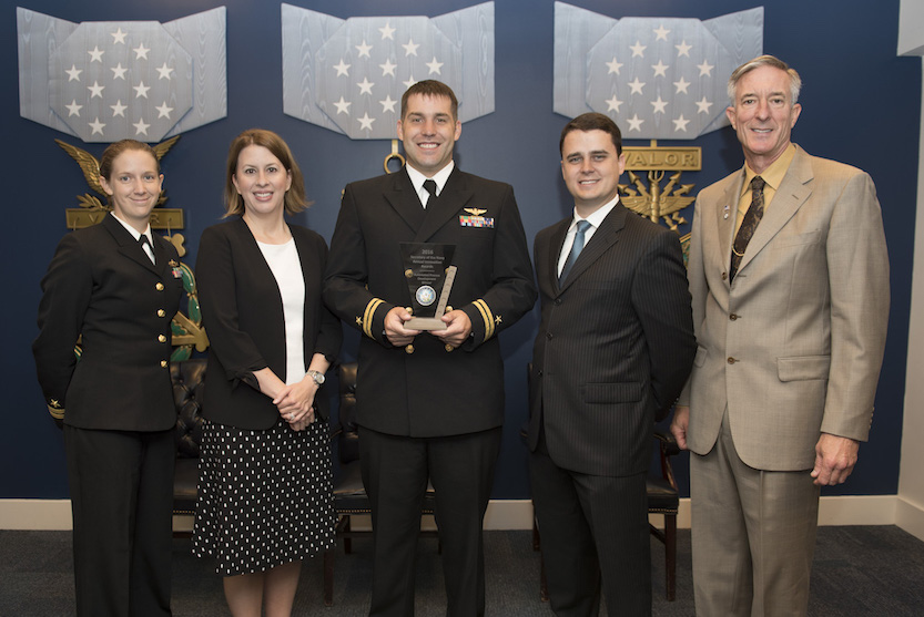
The SPAWAR ‘scanning team’ received the 2016 Secretary of the Navy (SECNAV) Innovation Award in the
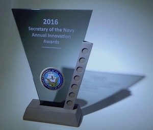
category of Automated Process Development in a prestigious ceremony officiated by Mr. Thomas Dee, performing the duties of the Under Secretary of the Navy, on June 5, 2017.
The SECNAV Innovation Awards recognize the top innovators within the Department of the Navy. Their accomplishments are remarkable and serve as inspiration for the entire Navy to think boldly and solve the fleet’s most challenging problems.
The Power of a Military-Civilian Workforce
The SPAWAR scanning team’s collaborative efforts showcased the power of a military-civilian workforce. Lt. Clay Greunke and Lt. Jessica Fuller, both currently assigned to SPAWAR Headquarters, worked hand-in-hand with SPAWAR scientists and engineers who had been developing and refining the recently recognized technology for more than three-consecutive years.
Stephen Cox, SPAWAR Systems Center (SSC) Pacific, chief engineer; Heidi Buck, director of the Battlespace Exploitation of Mixed Reality (BEMR) Lab; and Dr. Mark Bilinski, SPAWAR mathematician, all served as subject matter experts and advisors throughout the 3-D ship scanning and VR projects that took place in 2016.
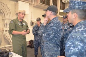
(U.S. Navy photo by Dawn Stankus)
“My role on the ‘scanning team’ was to bridge the gap between SPAWAR capabilities and how they could be used to address a fleet need,” said Greunke. “When I first reported to SPAWAR in late 2015, and heard about 3-D scanning, I reflected on my past work with virtual reality at the Naval Postgraduate School. This is when I knew we needed to start working together to address this fleet problem. What the team envisioned has now become a business model and has welcomed the Navy to virtual technology of the 21st century.”
The first ship that the team scanned was San Diego in April 2016. This project lasted nine-continuous days of 14-hour shifts and consisted of over 450 scans.
“Following the work on San Diego, we had collected 200 gigabytes of data which was later used to produce a 50 gigabyte 3-D virtual reality model of 70 percent of the ship, including C4I critical areas,” said Cox. “The effort was the first of its kind and, in my opinion, a complete success. I knew that this was only the beginning of something that would benefit shipboard equipment installation and overall space awareness for military and civilian personnel alike.”
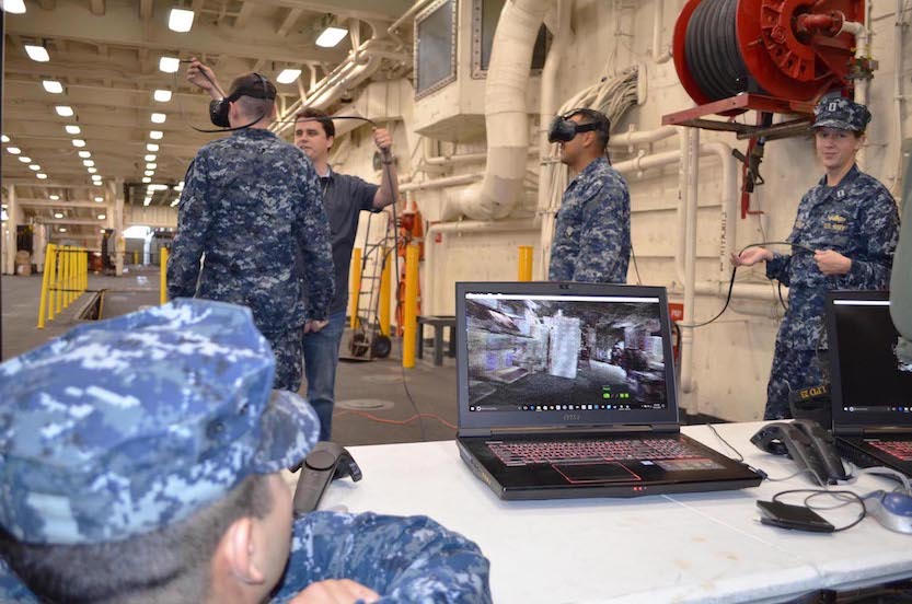
The SPAWAR scanning team utilized light detection and ranging (LIDAR) technology to create the most detailed, accurate and user friendly VE ever used for ship installations. The ship VE can be employed numerous times throughout the installation process, creating repeatable and verifiable measurements for installation planning, an interface for collaboration between installation teams, an intuitive way for engineers to identify installation discrepancies before hitting the deckplates, and an environment for Sailor 2025 virtual training with new installation equipment before it is even placed onboard the ships.
“The fleet needs this capability,” said Buck. “Our team used LIDAR technology to generate the most comprehensive and precise virtual environment. In addition to using these scans for installations, they can be used to support training initiatives and future prototyping initiatives. Sailors can now train ‘virtually’ on their ship, in their exact spaces, with their exact equipment because of these scans. Also new systems can be prototyped and inserted into the ‘virtual’ ship environment for design and testing purposes.”
Progressing Into The Future
For the most realistic and productive training, as well as the most current shipboard layout updates, Bilinski describes how important it will be to smoothly combine 3-D scanning and augmented reality (AR) as this capability progresses into the future.
“The trick is to combine 3-D scanning and augmented reality (AR),” said Bilinski. “If we give our Sailors AR enabled devices like tablets, goggles or other devices, then these technologies can use the 3-D scan as a map to help provide its Sailor with AR content, which then in turn helps that Sailor do his or her job. Behind the scenes, these devices would be scanning the areas of the ship that the Sailor passes through daily and therefore can identify changes and update the ship’s 3-D map. This technology will eventually close the loop and provide a mechanism to automatically refresh the ship’s documentation, all while making our Sailors more effective.”
Fuller emphasizes that the 3-D ship scanning success, and recently received recognition, would not have been possible without LIDAR technology.
“LIDAR technology requires only a small team of two to three people who know the equipment and can create an accurate, to the millimeter, virtual 3-D representation of a ship’s installation compartment,” said Fuller. “This process can be complete in a matter of hours and has been incredibly accurate throughout our testing and experiments. The virtual environment proves more ergonomically friendly to engineers while planning out future shipboard installations. Where traditional ship drawings cannot accurately reflect reality due to the current process limitations, LIDAR technology revolutionizes the process by potentially bypassing the first steps and moving straight into creating tangible documentation, greatly reducing the potential for human error, and increasing accuracy as well as providing a 3-D virtual space.”
In August 2016, the scanning team collaborated with Bath Iron Works (Planning Yard), while Truxtun was in port, and transformed Truxtun’s ship information documents (SIDs) into something more usable. By sharing the point cloud data generated from Truxtun, more accurate 2-D installation documentation was created. The team continues to work with different planning yards to aid them in integrating this technology into their current processes and to create more accurate 2-D documentation, alongside SPAWAR Fleet Readiness Directorate (FRD), in order to verify SIDs from the shipyard once received.
According to Greunke, this innovative approach presents the potential to reduce associated costs in shipbuilding, improve initial offerings, and eliminate expensive mistakes in the creation and utilization of technical drawings throughout the installation process.
“At the end of 2016, our team went on board USS Anchorage and conducted a 3-D ship scan,” said Greunke. “Anchorage leadership was extremely impressed with what we were able to accomplish in a few short days. We captured 3-D scans of various spaces, but focused our efforts mainly on the ship’s combat information center. 3-D scanning allows us at SPAWAR to thoroughly understand what new equipment and technology will fit in shipboard spaces following modifications and potential design flaws. This capability reduces assumptions and ultimately will save on time and cost.”
Following the 3-D ship scan, Anchorage leadership stated that as this technology continues to be refined it will significantly help shipboard Sailors and leaders throughout a ship’s lifecycle.
“A ship naturally experiences several space modifications and improvements throughout its lifetime,” said Capt. J.J. Cummings, Anchorage commanding officer. “For example, Anchorage just came out of a maintenance availability where we relied on ship drawings to help identify space discrepancies and to replace equipment. After one week, we have recognized that ship drawings, in some cases, were three-inches to even a foot off in measurement. What the team at SPAWAR was able to do [in only one week] was use 3-D scanning to showcase actual reality and shipboard specifications, so that we as a ship can make future plans. 3-D scanning is a capability that will improve our readiness and mitigate rework from my Sailors, shipyard workers or system installers.”
3-D Scanning Concept
Rear Adm. Ronald Fritzemeier, SPAWAR Chief Engineer, explains how the concept of 3-D scanning supports a much larger effort to encourage innovation throughout the fleet.
“We are absolutely thrilled that the hard work and creativity of our workforce is being recognized through such a prestigious award,” said Fritzemeier. “This award proves that all of us at SPAWAR are really invested in this effort. SPAWAR engineers and scientists are constantly brainstorming and when we have our different groups collaborating, we are able to develop the appropriate material and expertise necessary to support new ideas, such as 3-D ship scanning, for the fleet. 3-D ship scanning most importantly helps our Sailors and operators on ships, but this capability also helps other commands throughout the Department of the Navy, so that we can collectively improve design, modernization and system installation processes Navy-wide.”
Cox stressed that while LIDAR technology has existed for years, the problem with launching this idea was similar to what the Wright Brothers and other young pioneers faced during their time.
“Although we developed a new method, to produce a new product, which has far reaching applications, the challenge we faced was pitching it as a necessity to the fleet,” said Cox. “The brand new Sailors in the fleet are 20 years old or younger. They never knew a world without internet or cell phones. A decade from now, laser scanning of objects and structures, point cloud to CAD [computer-aided design] manipulation, additive manufacturing and virtual reality rendering will be as transparent to us as water to fish; they’ll be everywhere. Our job today is to get out in front of this wave of technology, and make sure the U.S. Navy is adopting the ‘it,’ at a rate and application, superior to our adversaries.”
Throughout the development stages and experiments, Greunke has recognized, even more, the importance of the military-civilian work relationship.
“I could not be more proud to have served, and to continue to serve, with this team,” said Greunke. “This idea started with Stephen Cox and his engineers, and then the BEMR Lab, and SPAWAR as a whole, came through with sufficient funding. In order to ‘innovate the fleet’ we need more than just those in uniform ‘who know the problems,’ we need to be working with civilian scientists, engineers and mathematicians who ‘know the underlying technologies’ that can solve them.”
Bilinski stated that the accomplished 3-D ship scans throughout 2016 prove to lay the groundwork for future endeavors that will provide increased capabilities to the world-wide Navy fleet.
“Regardless of the current technology and processes used to generate the documentation of our ships, the data eventually gets old and is only as good as our most recent ship check – which could be months or even years,” said Bilinski. “As we continue to explore the possibility of revolutionizing this dynamic, and can give our planners documentation that is only days, hours or even minutes old for every ship in the Navy, then we will eventually reach the true potential of 3-D scanning, virtual reality and augmented reality. To achieve this one day will be the greatest reward.”
Space and Naval Warfare Systems Command (SPAWAR) is the Navy acquisition command which develops, delivers, and sustains advanced information warfare capabilities for warfighters. SPAWAR, along with its system centers, space field activity, and its partnership with three program executive offices provides the hardware and software needed to execute Navy missions. With nearly 10,000 active-duty military and civilian professionals located around the world and close to the fleet, SPAWAR is at the forefront of research, engineering, and acquisition, keeping forces connected around the globe.


