San Diego City Council Redistricting
New City Council Districts Finalized
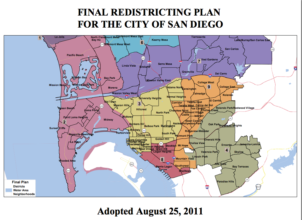
After months of public hearings and controversies, the city of San Diego’s Redistricting Commission has approved a new map for City Council districts. The final product from the commission represents a radical change from the current boundaries because a ninth district was squeezed in — the result of the 2010 vote that made the strong mayor form of government permanent.
The new District 9 will include the neighborhoods of Kensington, Talmadge and City Heights, areas that currently are in District 3 — which is represented by Councilman Todd Gloria — and runs south to Southcrest.
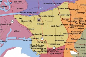
The new Council District 3 will include North Park, South Park, Golden Hill, University Heights, Normal Heights, Hillcrest, Balboa Park, Mission Hills, Bankers Hill, Park West, Old Town and Downtown. (Kevin Faulconer currently represents the Downtown area.)
“These communities will always mean a great deal to me and my family, and I am sorry to lose direct representation of them,” said Gloria of Kensington, Talmadge and City Heights.
Gloria said there is still some mystery about what the effective date of the new district boundaries will be. “Some authorities believe that council members begin representing the new districts this fall,” Gloria said. “The city attorney has opined that council members begin representing the new districts in December 2012, following the next election cycle.”
Because Gloria lives in City Heights, he might have to move into the new District 3.
The commission made only one change to its preliminary map, approved July 21, adjusting the boundaries of districts so that Linda Vista would only be split two ways instead of three. The commissioners previously rejected pleas from hundreds of residents of the Park Village section of Rancho Penasquitos to stay in a district with the rest of their community, rather than being placed in district to the south with Mira Mesa. “It just makes sense,’” Commissioner Carlos Marquez said of the new map. “I think most San Diegans, when they look at our final product, they will agree.’”
Commissioners have held 44 public meetings since last October and weathered a number of controversies and demands from interest groups. District boundaries are adjusted every 10 years to conform with updated census data.
“It’s been a long journey,’” Chairwoman Anisha Dalal said.

The Republican Party of San Diego County contended that the process used to select the seven commissioners was flawed because two retired judges made the picks instead of the required three, but their legal challenge failed. GOP leaders also were unable to remove Marquez from the panel despite questions over his residency.
Latino and Asian political activists demanded new majority districts.
Latinos already dominate District 8, represented by David Alvarez. About 44 percent of the new District 9 will be voting-age Latinos.
District 6 will be 34 percent Asian, over 18 years old.
The Asian Pacific American Coalition, in a statement, called it “an Asian-influenced district.” “After more than 40 years of waiting, APAC is eager to see the return of Asian-American representatives to San Diego City Hall,’” said APACs co-founder, Allen Chan.
The next step will be implementing the new map. City Attorney Jan Goldsmith has stated that the new boundaries will not take effect until December 2012, when the District 9 seat is filled. He wrote in a legal opinion that the current eight council members will continue to represent their current districts until December 2012.
The final map was approved by a unanimous 7-0 vote of the Redistricting Commission. (The final map can be viewed online at sandiego.gov/redistricting.) The vote concludes a nearly 10-month process by the seven volunteer commissioners that included 45 public hearings and public input provided by more than 2,000 residents and stakeholders. Sixteen hearings were held in neighborhoods throughout San Diego.
“Public input was critical to creating a final map, and the commission appreciates the involvement of hundreds of residents who are passionate about their neighborhoods,” stated Commission Chair Anisha Dalal. “Commissioners truly enjoyed getting to know so many great San Diegans who took time to participate in a truly democratic process.”
The commission’s goal was to create districts with as close to a population of 144,624 as possible. The panel considered U.S. Census data, public testimony, and legal criteria in the San Diego City Charter, the federal Voting Rights Act of 1965, and the U.S Constitution to create the final map.


